


Render Networks Integrates Trimble’s High-Accuracy GNSS to Revolutionize Real-Time Location Data in Network Deployments
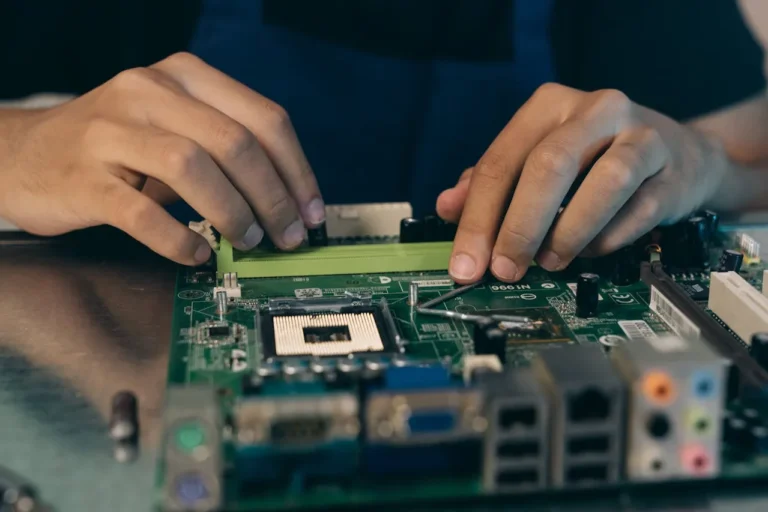
In a groundbreaking move set to transform the way broadband and utility networks are deployed, Render Networks, a leader in digitalizing network construction management, has announced a new integration with Trimble® Mobile Manager (TMM). This collaboration brings Trimble’s high-precision Global Navigation Satellite System (GNSS) capabilities directly into Render Networks’ platform, enabling field crews to capture centimeter-level accurate location data at the point of construction. The integration ensures that as-built records are not only complete but also verifiable from day one, significantly enhancing both short-term construction efficiency and long-term asset management.
Precision at the Core of Construction
The demand for precise asset location data is critical in telecom and utility projects. From fiber and conduit to drops, handholes, splice points, poles, or valves, every component must be accurately mapped for compliance, maintenance, and future locates. Traditional methods of capturing this data often involve manual processes, field revisits, and time-consuming reconciliation with Geographic Information Systems (GIS). These inefficiencies can lead to delays, increased costs, and strained budgets.
With the integration of Trimble’s high-accuracy GNSS solutions, Render Networks is addressing these challenges head-on. Field crews can now leverage Trimble receivers, including the Trimble DA2 with Trimble Catalyst and the Trimble R2, directly within Render Networks’ mobile app. This seamless integration empowers teams to capture survey-grade as-built data in real time, eliminating the need for rework and reducing the likelihood of errors.
“The increased demand for fiber infrastructure due to programs like BEAD (Broadband Equity, Access, and Deployment) has made capturing sub-centimeter location data more essential than ever,” said Craig Schellenbach, GIS Solutions Architect at ADB Companies. “The ability to combine Trimble’s high-accuracy solutions with Render’s automated construction workflows delivers survey-grade as-builts and close-out documentation for our projects in real time, the first time.”
Streamlining Workflows and Enhancing Efficiency
For Render Networks’ customers, this integration represents a game-changing advancement in how they manage large-scale infrastructure projects. By embedding high-precision GNSS capabilities into their existing workflows, field crews can now deliver fast, accurate, and verifiable as-builts without disrupting their normal operations. This eliminates costly site revisits, reduces rework, and accelerates project acceptance—a critical factor when working on timelines tied to government-funded initiatives like BEAD.
“Our customers are building critical infrastructure at massive scale, and high-accuracy data is non-negotiable,” said Rob Laudati, Chief Product and Partner Officer at Render Networks. “With this new integration, we’re giving crews the ability to capture as-builts with location accuracy in real time, accelerating closeout and ensuring data quality that supports compliance, operations, and asset management for decades to come.”
This level of precision doesn’t just benefit immediate construction efforts; it also lays the groundwork for robust long-term asset management. Accurate as-built records ensure that utilities and telecom providers have reliable data to inform maintenance activities, plan future expansions, and comply with regulatory requirements. In an era where infrastructure resilience and scalability are paramount, having access to verified, high-quality data is a competitive advantage.
A Solution Tailored for Modern Challenges
The timing of this integration couldn’t be better. Governments and private organizations worldwide are investing heavily in expanding broadband and utility networks to meet growing demand. Programs like BEAD in the United States highlight the urgency of these initiatives, which require unprecedented levels of precision and efficiency. Render Networks’ partnership with Trimble equips construction teams with the tools they need to meet these demands while maintaining the highest standards of accuracy and reliability.
Trimble’s GNSS technology has long been recognized as a gold standard in positioning solutions, offering unparalleled accuracy even in challenging environments. By integrating this capability into its platform, Render Networks is bridging the gap between cutting-edge technology and practical, on-the-ground applications. The result is a solution that not only meets today’s needs but also anticipates tomorrow’s challenges.
Showcasing Innovation at SCTE TechExpo
Render Networks will demonstrate the power of this new integration at the upcoming SCTE TechExpo, taking place from September 29 to October 1 in Washington, D.C. Attendees visiting Booth #882 will have the opportunity to see firsthand how the combination of Render Networks’ automated workflows and Trimble’s high-precision GNSS capabilities is transforming the construction landscape.
The demo will highlight how field crews can seamlessly capture and utilize real-time location data, streamlining their workflows and delivering superior results. For telecom and utility professionals seeking ways to enhance efficiency and ensure compliance, this showcase promises to provide valuable insights into the future of network deployment.
About Render Networks
Founded in 2013 with a mission to build and connect communities faster, Render Networks has a successful history of streamlining large-scale network construction for operators and builders. By automating manual tasks and optimizing the productivity of every resource, Render’s digital construction management platform eliminates inefficiency, achieving real-time transparency and building networks faster. For more information, visit www.rendernetworks.com and follow us on LinkedIn.